
La version française suit
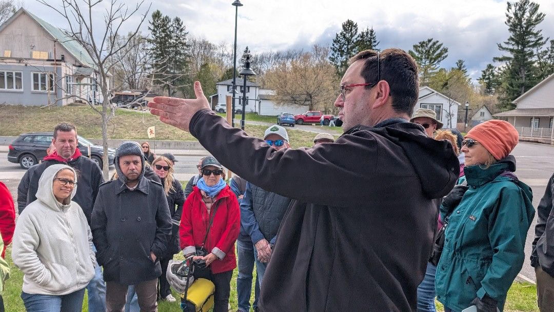
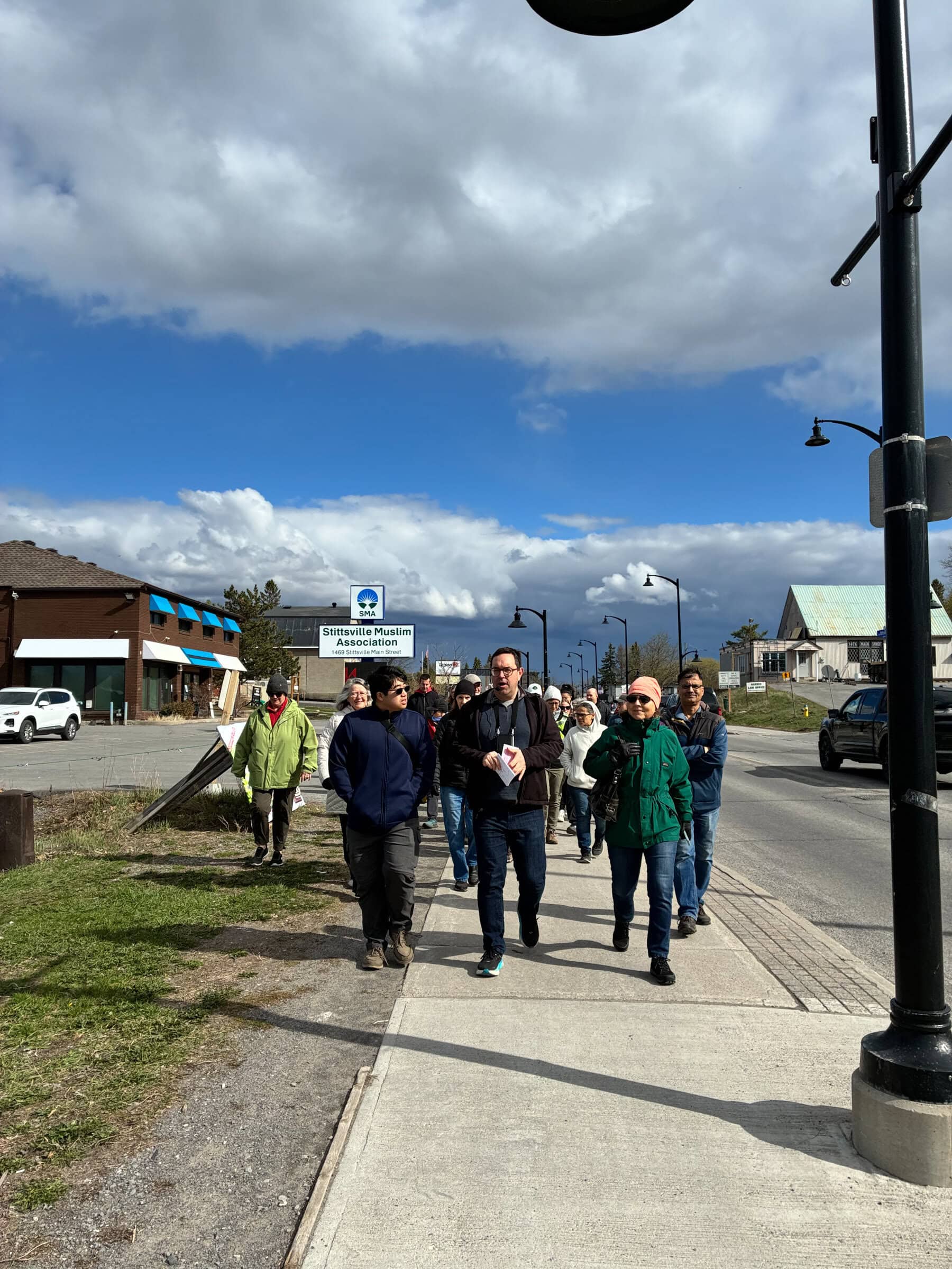
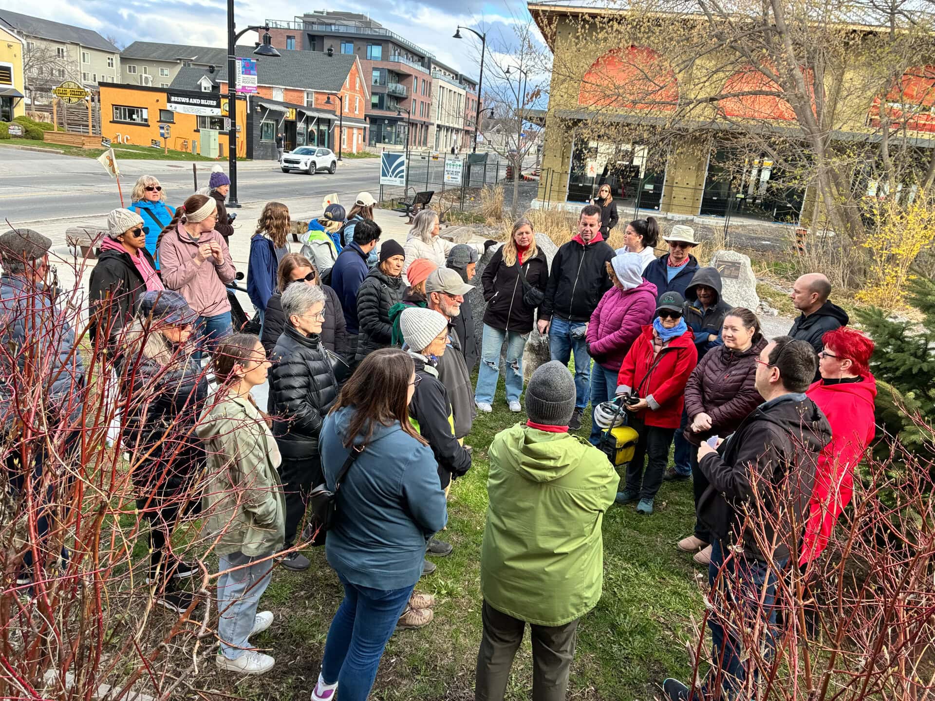
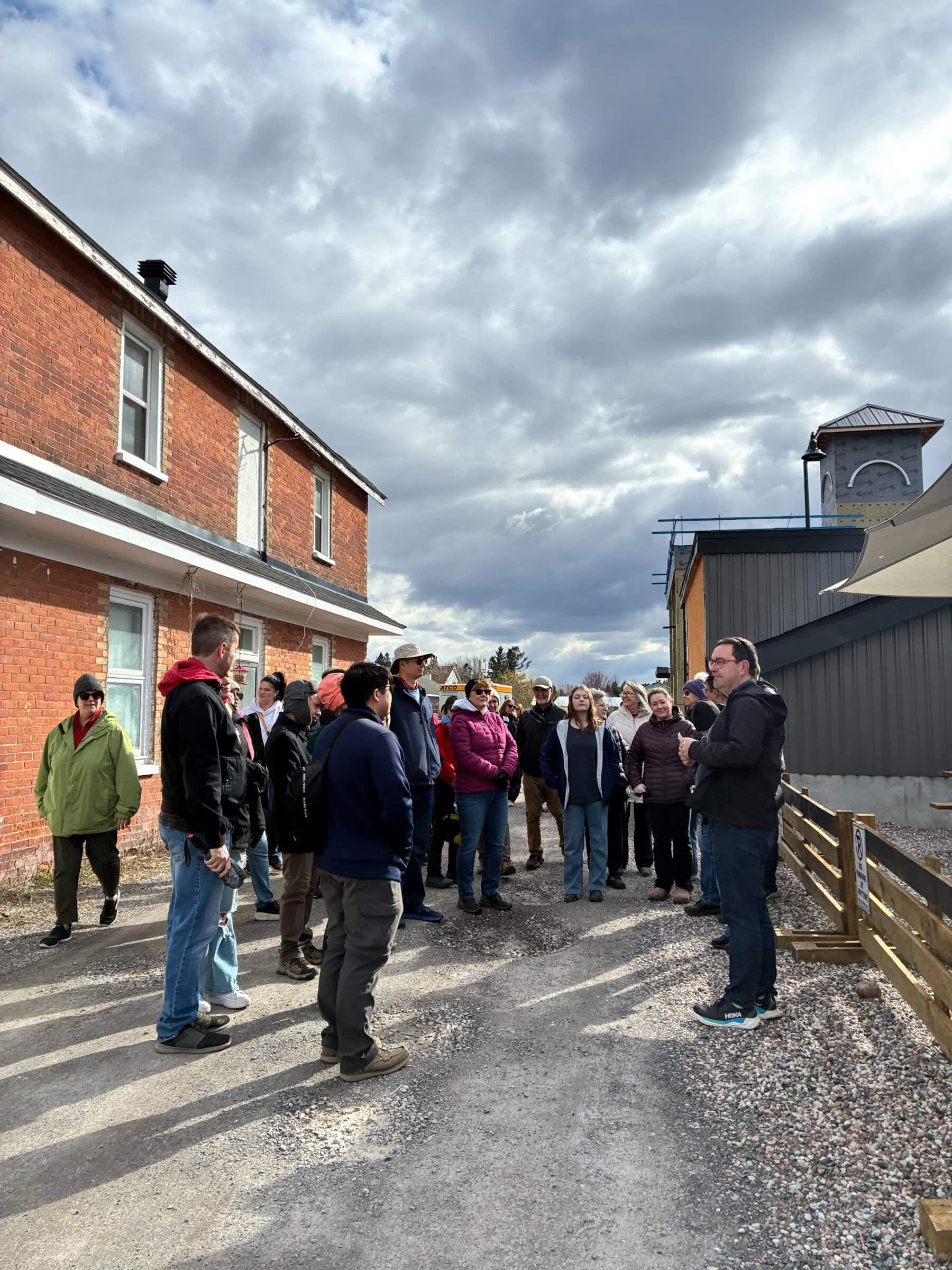
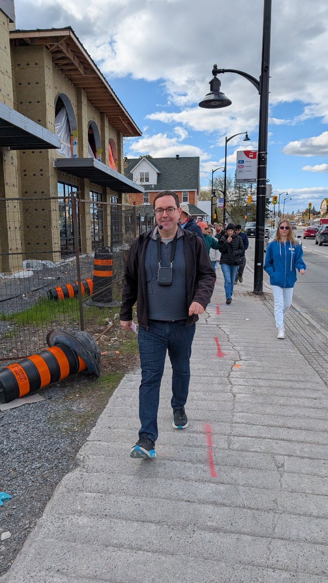
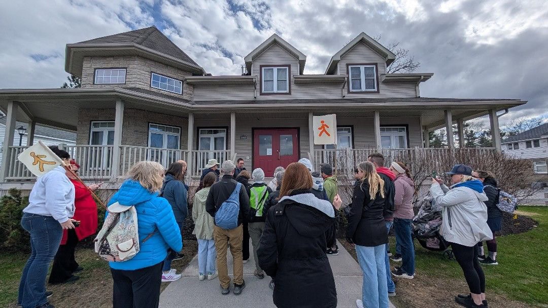
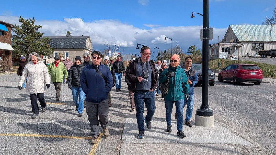
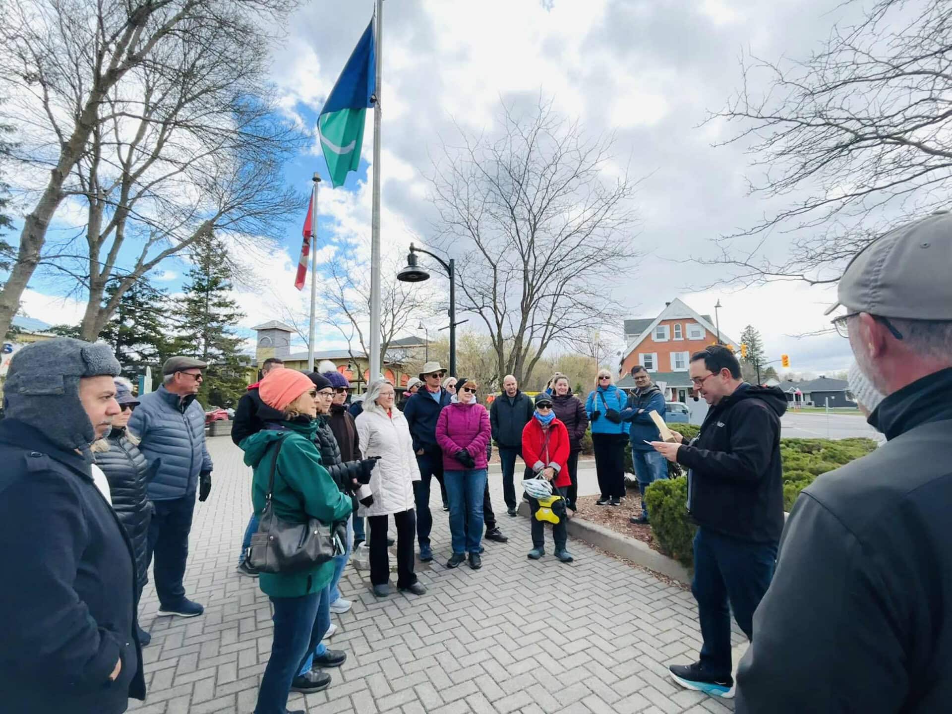
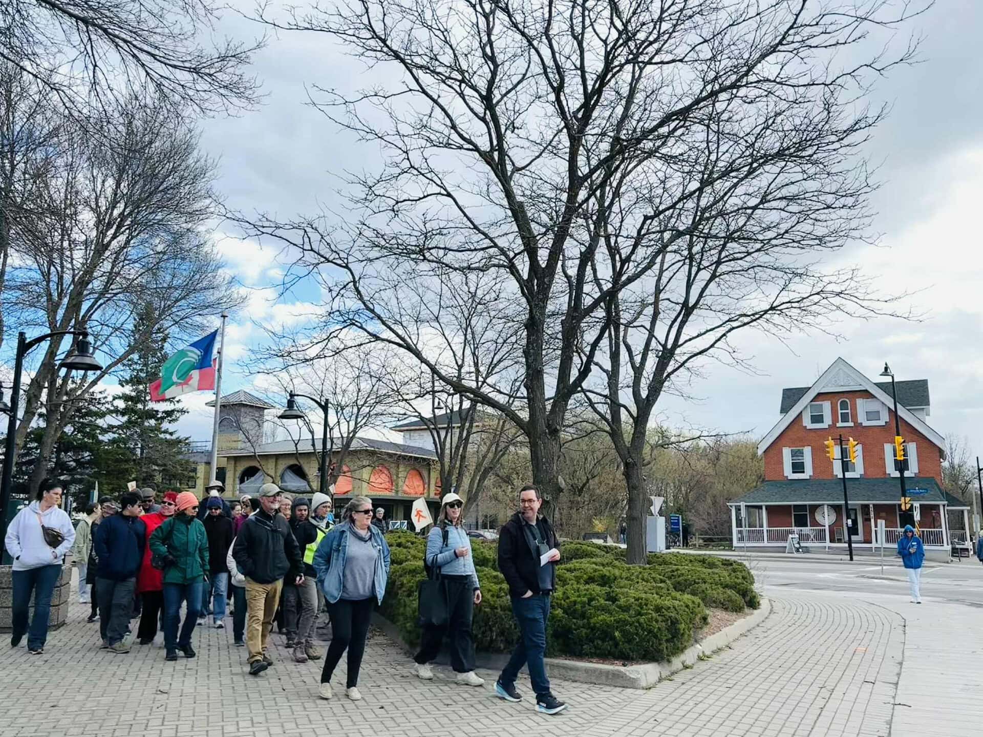
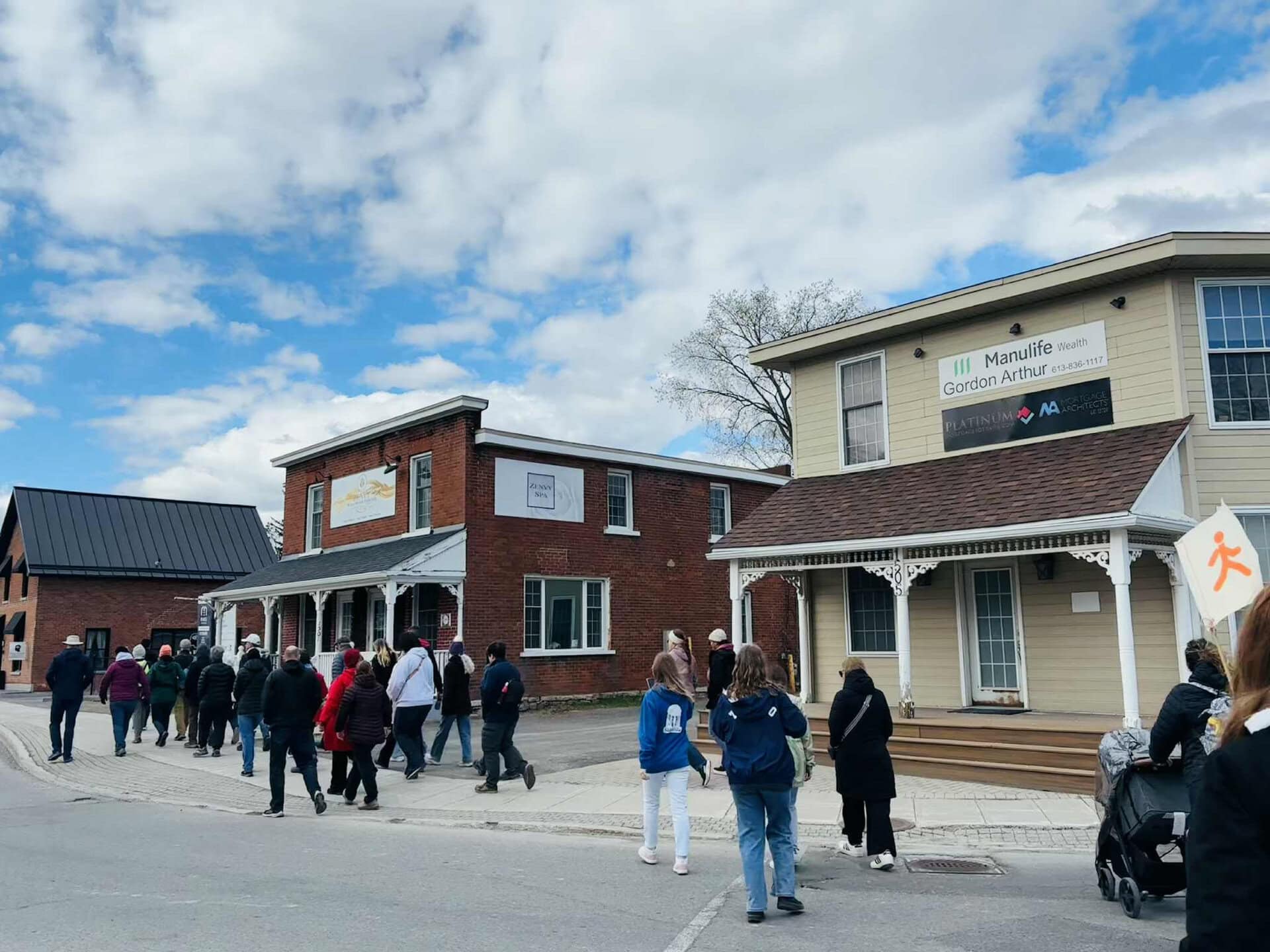
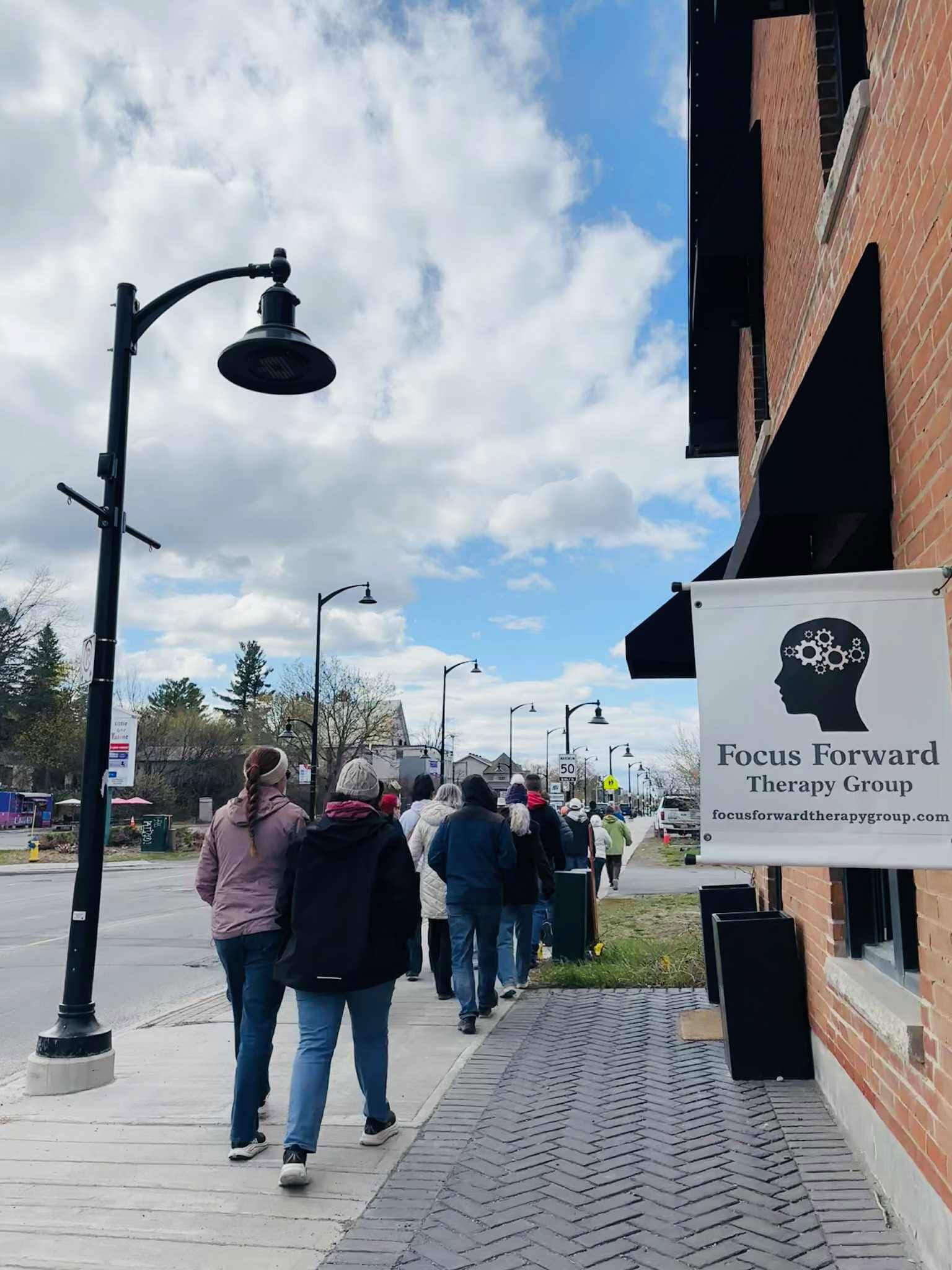
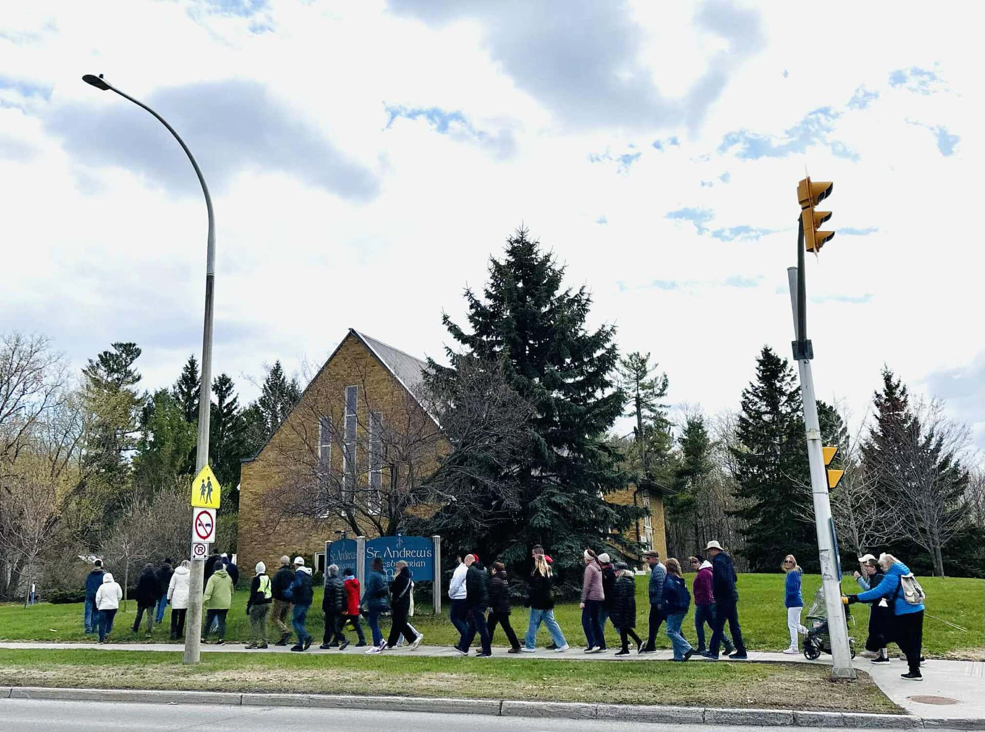
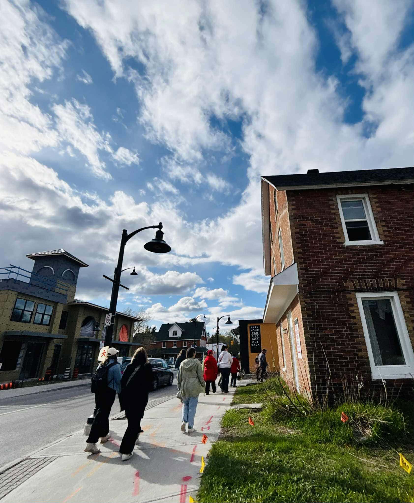
About 40 people joined us on Saturday for the annual Jane’s Walk on Stittsville Main Street. It was part of the Ottawa Jane’s Walk Festival with dozens of free walking tours happening all over Ottawa (and many more happening around the world).
This year’s walk focused on the history, present state, and future of the street, and how it has transformed from “string town” to suburb. I’ve been leading this walk since 2016, and over ten years I’ve seen a lot of change on the street: Several new buildings, a lot of new businesses, new LED streetlamps, a new public square.
After ten years, it’s a good opportunity to take stock of where we’ve been, and where we may be going.
Photos by Mandy Hambly, Marlova Martin, and Laura Mueller.
Stittsville’s origin story
Indigenous people have lived in our area for millennia. There’s no direct evidence that they settled or travelled on what’s now Stittsville Main Street*, but their presence in the area is well-established. In 2006, during the construction of Holy Spirit Parish 1,200 metres away at Shea and Abbott, archeologists discovered over 800 artifacts dating back 9,000 years.
(*I have no idea when the street was first referred to as “Main Street”. It started being known as “Stittsville Main Street” sometime around the municipal amalgamation in 2000. Throughout this article I’ve used modern street names for clarity, although several streets have had different names over the years.)
The first settler surveys in this area were done around 1817 when it was largely swamp and forest. The road that would become “Stittsville Main Street” left the military settlement of Richmond and forged northward, staying fairly straight save for a few curves to avoid low, swampy areas. The road would intersect with another road (now Hazeldean Road) that crossed the northern end of Goulbourn Township from east to west, between the 11th and 12th concessions.
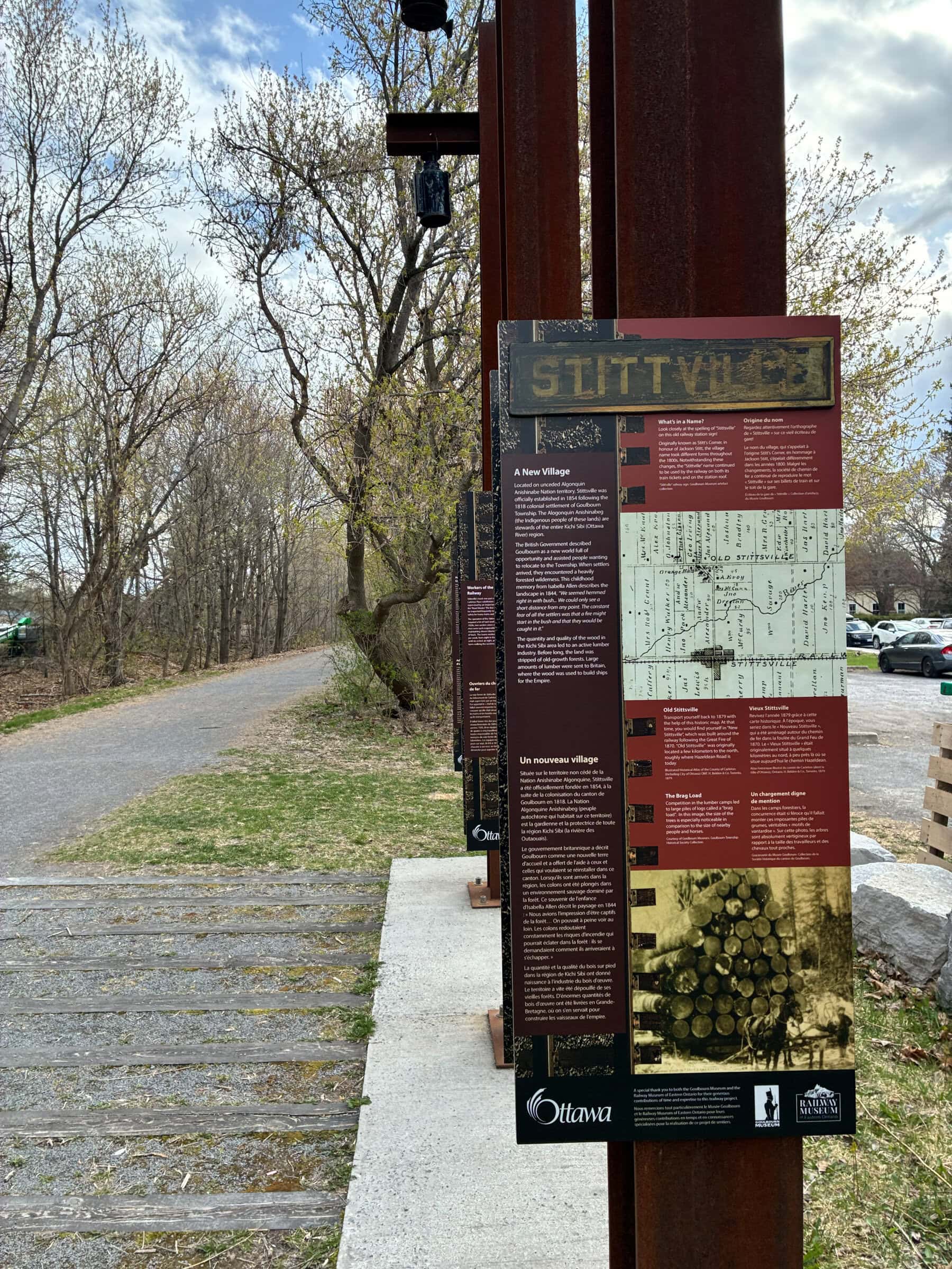
From that crossroads, you could have headed south to Richmond, north to Carp, east to Hazeldean and Bells Corners, or west to Carleton Place. Up sprang a small settlement at around 1820 around the triangle bounded today by Stittsville Main Street, Hazeldean Road, and Carp Road. By the 1840s this settlement was known as “Stitts Corners”. Jackson Stitt became the settlement’s first postmaster in 1854.
The Great Fire blazes a new course
The Great Fire of August 1870 would change everything. On a windy day in the middle of a hot, dry summer, workers clearing the brush between Almonte and Pakenham for a new railway sparked a fire that devastated much of Carleton County. Almost everything in Stittsville was destroyed, save for a few stone buildings including two that still stand today: Kemp’s Tavern (now Cabotto’s on Hazeldean Road) and the little stone cottage on Maple Grove Road in Fairwinds.
The railway eventually was completed, following what’s now the Trans Canada Trail, along with a train station in Stittsville just east of the main road – now the site of Village Square Park. The centre of Stittsville shifted from the old “Stitts Corners” towards the train station, and a number of shops, hotels, and local businesses sprang up in the late 19th century and early 20th centuries.
A “string town”
It’s hard to imagine from today’s perspective, but for most of Stittsville’s history the main street was not only the main road, but also one of the *only* roads in the community. The community was referred to as a “string town”, meaning that most of its buildings and institutions were along one very long street, with very few cross-streets or secondary roads.
The first subdivision was created in 1901 with several homes back-to-back on Abbott Street and Manchester Street, west of Main Street. Additional subdivisions didn’t come until after the Second World War.
That linear layout makes the street quite different than other “traditional main streets” in our area. It lacks the grid-like structure and intersections of the Glebe or Westboro, and it’s way less compact than old main streets in Carleton Place or Almonte. It remained very much rural in character until well into the 20th century.
Post-war ambition
The people who lived in Stittsville immediately following WWII were an ambitious bunch. In the late 1940s they opened a new elementary school (Stittsville Public School, now Frederick Banting Secondary Alternative School and home to the Home Bosses Youth Centre). It was a model of a modern elementary school and school board officials from across the province came to visit. At about the same time the community established a Board of Trade, and an Urban Development Area – a first stab at a master plan and zoning for the village.
In 1956 Stittsville became a “Police Village”, which gave decision-making and budget powers to local elected officials, within the broader Goulbourn Township. By the early 1960s, Stittsville was recognized formally as a “village”.
This period also marked the start of suburban growth and car commuting, with Stittsville a convenient distance from jobs in Ottawa. The first post-war subdivisions were established in the older parts of Stittsville on large lots, due to the need for wells and septic. Streets like Pretty and Ralphpark, Henry Goulbourn and Norway Spruce, Coach and Conductor, Brigade and Bell Park, just to name a few.
Through the 60s and 70s Stittsville welcomed new churches, a community centre and arena (Johnny Leroux Arena), a post office, a fire hall, a library, all along (or very close to) Stittsville Main Street. Goulbourn Non-Profit Housing built a two-storey affordable apartment building on Carleton Cathcart.
In the late 1970s, the town council decided to connect the village to municipal water and sewage. That, combined with construction of the Queensway to the west end in the 1980s, would eventually shift Stittsville’s focus away from Main Street towards the close of the century.
End of the railway
The last VIA Rail train travelled through Stittsville in January 1990, making the end of nearly 120 years of rail. Soon the tracks would be torn up, the rail buildings demolished, and the crossing arms removed from Main Street.
In 1991, work began to upgrade Main Street. The $8-million project was funded by the Regional Municipality of Ottawa-Carleton and Goulbourn Township, and included burying hydro lines, building sidewalks on both sides of the street, and boulevards, trees, and street lamps.
In 1996 the site of the old train station was redeveloped as Village Square Park, including the first version of the railway-themed play structure. (The second generation of the play structure opened in 2024.) The old rail lines were removed and the Trans Canada Trail was established by 2000, connecting from Bells Corners to Carleton Place.
There’s an old painting by Ben Babelowsky at City Hall capturing Stittsville as it looked around 1999-2000. Looking northward from about where the pedestrian crosswalk is now, it depicts a colourful collection of small two-storey buildings, a mix of shops and restaurants, and a local police station.
The painting is one of a collection of depictions of cities and townships before they were amalgamated into the City of Ottawa in 2000.
A planning crisis and the Community Design Plan
With amalgamation, “Main Street” became “Stittsville Main Street” to differentiate it from all the other ones across Ottawa. Amalgamation also coincided with the start of an economic decline on the street, despite continuing residential growth overall in the community.
I think there were a few factors at play here: Stittsville’s residential development was shifting north, west, and south. Newer retail pads built in the 1990s and 2000s on the north end of Stittsville Main and along Hazeldean Road shifted the retail centre of the community northward. A few of the older buildings burned down.
Around 2010, a proposed mixed-use apartment building and townhomes next to the Stittsville Legion sparked an uproar. At five storeys, it would have been the tallest building on the street in one of the narrowest sections. After a few twists and turns, the townhomes were built, the apartment building was not, and part of the lot remains for sale today.
But that development would still have a major impact. Responding to community interest, former councillor Shad Qadri launched a “Community Design Plan” process for Stittsville Main Street. Approved in 2015, it provided a blueprint for future development on the street from Hazeldean Road to Bobcat Way. The vision was for a vibrant neighbourhood with more homes, businesses and services in old and new buildings. It included a four-storey height limit; a preference for mixed use (retail on the bottom, apartments on top); and highlighting opportunities for community enhancements (public art at the corner of Carleton Cathcart; a public square at the trail south of Abbott; acquiring Frederick Banting school for city recreational use should it ever go up for sale).
Revitalization begins
The plan estimated that Stittsville Main had the capacity for about 2,200 housing units between 2015-2031. More than a decade on, we’re nowhere near the target, but there have been several developments:
- The Switzer (1531 Stittsville Main) – 43 apartments, opened 2022
- The Landing (1370 Stittsville Main) – 71 apartments, opened 2025
- The Station (1518 Stittsville Main) – 27 apartments, under construction
- 1412 Stittsville Main – 18 apartments, under construction
All of these were permitted “as of right” under the Community Design Plan and required no rezoning. Each of them (except for 1412 Stittsville Main) includes retail on the ground floor and apartments above. Together, that’s just over 150 apartments.
(We could also include the 37 Wildpine apartment development just off of Stittsville Main, with 93 apartments. It’s still going through the approval process.)
Besides housing, there’s been a large crop of new businesses opening up on the street. Most of them are independently owned and operated, taking advantage of cheaper rents in older buildings. The street has become an incubator for a score of women-owned and diversity-owned businesses. Restaurants, retail shops, and more. Jane Jacobs would approve.
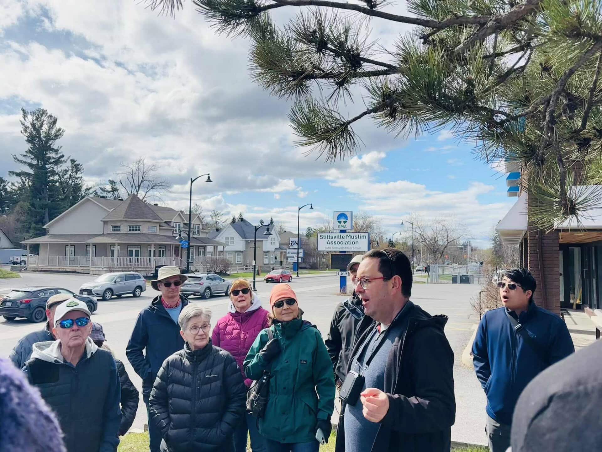
Even the Stittsville Muslim Association has moved in, adapting the old Bradley’s Insurance building at 1469 Stittsville Main Street for a temporary mosque and school while they search for a larger property elsewhere in Stittsville.
In the first few years of my Jane’s Walk, we would stop on the porch of the old Green’s Hotel / Butler’s Hotel at the corner of Stittsville Main and Abbott. At the time, it was home to Hudson’s Insurance and I would talk about how great it would be to have a coffee shop or a brew pub open up. Today, it’s home to Ritual Café owned by Chinelo Houron – a popular stop for cyclists and walkers along the Trans Canada Trail.
Instead of stopping at the porch of the building, now we gather at Bradley’s Square. Completed in 2019 with main street stimulus funding from the provincial government, it was one of the projects identified in the 2015 community design plan, and renamed for the Bradley family’s historic contributions to Stittsville in 2022.
Looking down the road
Stittsville ward has about 55,000 people today, and will grow by another 25,000 in the coming decades. As far as Ottawa’s suburbs go, our main street is unique: the character, the mix of old and new, and the growing ranks of eclectic businesses.
One of the big challenges is transportation. Stittsville Main is somewhere between a road and a street: a “stroad”. It’s a road, in the sense that it’s an artery for vehicles heading north and south in the community. It’s a street, in the sense that it is lined with small shops and quite walkable.
In the future it will have to shift more towards a street, because neighbourhood-scale retail thrives on streets and struggles on roads. New roads like Robert Grant Avenue will deflect north-south traffic away from Stittsville Main. And the 2022 Public Realm Plan and subsequent 2025 Transportation Master Plan call for new sidewalks and pathways on both sides of the street – making it safer and more convenient for pedestrians and cyclists and connecting to the Trans Canada Trail. OC Transpo route 163 launched in 2025 and Route 61 service will become more frequent soon.
In the next few years Stittsville Main will be extended northward, connecting through Jackson Trails and Connections to Palladium Drive and then the Queensway. The old road to Carp will soon become a road to Kanata and beyond.
There will be new apartment buildings, both on the street and nearby. Thanks to the rural origins of the street, most lots are large and deep, making them ideal for housing and retail. The old firehall at Carleton Cathcart is due for a major rebuild, where the City will create a permanent home for the Stittsville Food Bank, likely along with affordable housing and community meeting rooms.
Meanwhile close to Hazeldean Road, new provincial policy has superseded the 4-storey limit established in the 2015 Stittsville Main Street Secondary Plan. Provincial rules mean that maximum heights are now 10-18 storeys between Hobin and Hazeldean. So if the strip malls or school board land ever gets redeveloped, we’re likely to see some taller mixed-use buildings.
Change is constant
I can’t remember where I heard or read it, but a smart urban planner observed that while land uses change over time, and buildings may come and go, the roads will always be there.
Walking up and down the road, you can see evidence of every part of Stittsville’s history. Architecture from many decades, and clues about the rural and railway history of the village. I wonder if the original surveyors and settlers of Goulbourn Township had any concept that the road they plotted north from Richmond Road to Concession Line XI would eventually become the backbone of a growing 21st century suburb in the Nation’s Capital?
Ten years ago when I started the Jane’s Walk, Stittsville Main was at the very start of its modern revitalization. We’re still in the very early stages, it’s far from perfect, and there are some growing pains. But in new buildings like the Switzer or The Station, you can see a glimpse of where the street is going, and what it might become over the next 25 years.
I’ll see you around the neighbourhood.
Sources consulted for this article include:
- Stittsville: A Sense of Place by Barbara Bottriell
- Goulbourn Township Historical Society
- Goulbourn Museum
- StittsvilleCentral.ca
CARNET DE NOTES : Portrait de la rue Stittsville Main
Ce samedi, une quarantaine de personnes se sont jointes à nous pour La promenade de Jane sur la rue Stittsville Main. Cet événement annuel s’inscrivait dans le programme ottavien du festival La promenade de Jane, organisé dans plusieurs villes du monde, qui proposait des dizaines de visites guidées gratuites aux quatre coins de la ville.
L’édition de cette année portait sur l’histoire, l’état actuel et l’avenir de cette rue qui est passée de cité linéaire à coin de banlieue. Je mène cette marche depuis 2016. En plus de dix ans, j’ai pu observer beaucoup de changements sur la rue, dont la construction de plusieurs bâtiments, l’ouverture de nombreux commerces, l’installation de lampadaires à DEL et l’aménagement d’une nouvelle place publique.
Le moment est bien choisi pour réfléchir au chemin parcouru et à la direction que nous pourrions prendre.
Photos : Mandy Hambly, Marlova Martin et Laura Mueller
Les origines de Stittsville
Notre région est habitée par des peuples autochtones depuis des millénaires. Rien ne permet d’affirmer avec certitude qu’ils se soient établis ou qu’ils aient circulé précisément sur ce qui est aujourd’hui la rue Stittsville Main1, mais leur présence dans le secteur est connue. Lors des travaux de construction de l’église Holy Spirit menés en 2006 à l’angle du chemin Shea et de la rue Abbott, des archéologues ont découvert plus de 800 artefacts datant de 9 000 ans* à 1 200 mètres de la rue.
(1 J’ignore quand cette rue a commencé à s’appeler « Main », mais nous savons que l’appellation « rue Stittsville Main » s’est imposée vers la fusion municipale, en 2000. Dans mon billet, j’utilise les noms actuels par souci de clarté, même si, au fil des ans, plusieurs des rues mentionnées ont porté d’autres noms.)
Les premiers relevés d’arpentage réalisés par les colons dans ce secteur remontent à environ 1817. À l’époque, le territoire était essentiellement couvert de marécages et de boisés. Le chemin qui allait devenir la rue Stittsville Main montait vers le nord à partir de l’établissement militaire de Richmond, dans une ligne relativement droite ponctuée de quelques courbes contournant des zones basses et marécageuses. Il croisait une autre route – aujourd’hui le chemin Hazeldean – qui traversait l’extrémité nord du canton de Goulbourn* d’est en ouest, entre les concessions 11 et 12.
À cette intersection, on pouvait aller vers le sud en direction de Richmond, vers le nord en direction de Carp, vers l’est en direction de Hazeldean et Bells Corners, ou vers l’ouest en direction de Carleton Place. Vers 1820, un petit établissement a vu le jour autour du triangle aujourd’hui délimité par la rue Stittsville Main, le chemin Hazeldean et le chemin Carp. Dans les années 1840, on l’appelait « Stitt’s Corners ». Jackson Stitt en est devenu le premier maître de poste en 1854.
L’effet transformateur du grand incendie
Le grand incendie d’août 1870* a eu un effet déterminant. Un jour venteux de cet été chaud et sec, dans un boisé situé entre Almonte et Pakenham, des travailleurs s’affairaient à déblayer un chemin pour l’aménagement d’une voie ferrée lorsqu’un incendie a ravagé une bonne partie du comté de Carleton. Stittsville a été presque entièrement détruite, à l’exception de quelques édifices en pierre, dont deux sont encore debout aujourd’hui : la Kemp’s Tavern* (l’actuel Cabotto, sur le chemin Hazeldean) et un petit cottage de pierre* du chemin Maple Grove, dans Fairwinds.
Après la construction du chemin de fer le long de l’actuel Sentier transcanadien, une gare ferroviaire est bâtie à Stittsville, tout juste à l’est de la rue principale, dans l’actuel parc Village Square. Le cœur de Stittsville se déplace ensuite de Stitt’s Corner vers la gare, autour de laquelle plusieurs magasins, hôtels et entreprises s’installent à la fin du XIXe et au début du XXe siècle.
Cité linéaire
Bien que ce soit difficile à imaginer de nos jours, il faut savoir que, pendant la majeure partie de l’histoire de Stittsville, la rue principale n’était pas seulement la principale artère du coin; c’était aussi l’une des *seules* routes du secteur. Stittsville était alors considérée comme une « cité linéaire », c’est-à-dire un endroit où la plupart des bâtiments et des établissements sont situés aux abords d’une seule rue très longue entrecoupée de quelques rues transversales ou routes secondaires.
Le premier lotissement a vu le jour en 1901, avec plusieurs maisons construites dos à dos sur les rues Abbott et Manchester, à l’ouest de la rue Main. Ce n’est qu’après la Seconde Guerre mondiale que d’autres lotissements se sont développés.
Cette organisation linéaire confère à la rue un aspect qui la distingue nettement des autres rues principales traditionnelles de la région. En effet, on n’y trouve ni le quadrillage ni les intersections du Glebe ou de Westboro, et l’aménagement y est beaucoup moins compact que sur les rues principales plus anciennes de Carleton Place ou d’Almonte. Pendant une bonne partie du XXe siècle, la rue a aussi conservé un caractère résolument rural.
L’ambition de l’après-guerre
Au sortir de la Seconde Guerre mondiale, la population de Stittsville brille par son ambition. À la fin des années 1940, la communauté se dote d’une nouvelle école élémentaire, la Stittsville Public School (aujourd’hui l’École secondaire alternative Frederick-Banting, qui abrite également le Centre de la jeunesse Home Bosses*). L’établissement fait figure de modèle d’école élémentaire moderne, au point d’attirer des représentants de conseils scolaires des quatre coins de l’Ontario. C’est à peu près à la même époque que la collectivité crée une chambre de commerce et délimite une zone d’expansion urbaine; c’est le début d’un plan directeur et plan zonage pour le village.
En 1956, Stittsville obtient le statut de village partiellement autonome, ce qui confère aux élus locaux des pouvoirs décisionnels et budgétaires au sein du canton de Goulbourn. Au début des années 1960, Stittsville obtient le statut officiel de village.
C’est à cette période que s’amorce la croissance suburbaine et que débutent les déplacements quotidiens en automobile, puisque Stittsville se trouve à une distance commode des lieux d’emplois à Ottawa. Les premiers lotissements d’après-guerre sont installés dans les secteurs anciens du village, sur de grands terrains, vu la nécessité de l’aménagement de puits et d’installations septiques. On y trouve plusieurs voies de circulation, comme Pretty, Ralphpark, Henry Goulbourn, Norway Spruce, Coach, Conductor, Brigade et Bell Park, pour n’en nommer que quelques-unes.
Tout au long des années 1960 et 1970, Stittsville accueille de nouvelles églises, un centre communautaire et un aréna (l’aréna Johnny-Leroux*), un bureau de poste, une caserne de pompiers et une bibliothèque, tous situés sur la rue Stittsville Main ou à proximité. La Goulbourn Non-Profit Housing Corporation construit aussi un immeuble de logements abordables de deux étages sur la rue Carleton Cathcart.
À la fin des années 1970, le conseil municipal décide de raccorder le village aux réseaux municipaux d’aqueduc et d’égout. Avec cette décision, et avec la construction du Queensway, à l’ouest, dans les années 1980, Stittsville allait progressivement détourner son attention de la rue Main vers l’approche de la fin du siècle.
La fin du chemin de fer
C’est en janvier 1990 que le dernier train de VIA Rail traverse Stittsville*, ce qui met fin à près de 120 ans de présence ferroviaire. Peu après, les rails sont arrachés, les bâtiments ferroviaires, démolis, et les barrières de passage à niveau, retirées de la rue Main.
En 1991, des travaux de réaménagement de la rue Main sont entrepris. Ce projet de 8 millions de dollars, financé par la Municipalité régionale d’Ottawa-Carleton et le canton de Goulbourn, comprenait l’enfouissement des lignes de transport de l’électricité, l’aménagement de trottoirs des deux côtés de la rue ainsi que la création de boulevards, la plantation d’arbres et l’installation de lampadaires.
En 1996, le site de l’ancienne gare est réaménagé; il devient le parc Village Square, doté d’une première version de module de jeu à thème ferroviaire*. (La deuxième version a quant à elle été inaugurée en 2024*.) Avant l’an 2000, la voie ferrée a été retirée et le Sentier transcanadien reliant Bells Corners à Carleton Place a été aménagé.
On peut voir à l’hôtel de ville un tableau de Ben Babelowsky qui représente Stittsville vers 1999-2000. On y voit, du point de vue qu’offre l’emplacement approximatif de l’actuel passage pour piétons lorsqu’on regarde vers le nord, un ensemble coloré de petits immeubles à deux étages abritant des commerces et des restaurants, ainsi qu’un poste de police local.
Cette œuvre fait partie d’une série représentant les villes et les cantons avant leur fusion à la Ville d’Ottawa, en 2000.
Crise d’urbanisme et plan de conception communautaire
Avec la fusion municipale, la rue Main a été renommée Stittsville Main, ce qui la distinguait des nombreuses autres voies portant le même nom à Ottawa. Cette période correspond d’ailleurs au début d’un déclin économique sur la rue, qui est survenu en dépit d’une croissance résidentielle continue dans toute la communauté.
Selon moi, divers facteurs sont en cause. D’abord, le développement résidentiel rayonnait vers le nord, l’ouest et le sud. Les nouveaux ensembles commerciaux construits dans les années 1990 et 2000 à l’extrémité nord de la rue Stittsville Main et le long du chemin Hazeldean ont déplacé le pôle commercial du quartier vers le nord, et certains anciens bâtiments ont été ravagés par des incendies.
Vers 2010, un projet d’immeuble d’utilisation polyvalente abritant des appartements et des maisons en rangée visant un terrain près de la Légion de Stittsville fait controverse. Avec ses cinq étages, l’immeuble aurait été le plus élevé de la rue, tout en étant situé dans l’un de ses tronçons les plus étroits. Après quelques revirements, les maisons en rangée ont été construites*, l’immeuble d’appartements a été abandonné, et une partie du terrain est toujours à vendre.
Ce projet a néanmoins eu un effet déterminant. En réponse à l’intérêt de la population, l’ancien conseiller municipal Shad Qadri a lancé un processus d’élaboration de plan de conception communautaire pour la rue Stittsville Main. Approuvé en 2015, ce document proposait un plan d’aménagement de la rue entre le chemin Hazeldean et la voie Bobcat. La vision était celle d’un quartier dynamique offrant davantage de logements, de commerces et de services, à la fois dans le cadre bâti existant et dans de nouvelles constructions. Le plan prévoyait une hauteur maximale de quatre étages, privilégiait les utilisations polyvalentes (commerces au rez-de-chaussée et logements aux étages) et préconisait les possibilités d’aménagements communautaires (installation d’art public à l’angle de la rue Carleton Cathcart, création d’une place publique près du sentier au sud de la rue Abbott, possible acquisition de l’école Frederick-Banting à des fins récréatives municipales advenant une mise en vente).
Début de la revitalisation
Selon ce plan, entre 2015 et 2031, la rue Stittsville Main pouvait accueillir quelque 2 200 logements. Plus de dix ans après son adoption, cet objectif est loin d’être atteint, mais plusieurs projets ont néanmoins vu le jour :
- Le Switzer (1531, rue Stittsville Main) : 43 appartements, inauguration en 2022
- Le Landing (1370, rue Stittsville Main) : 71 appartements, inauguration en 2025
- Le Station (1518, rue Stittsville Main) : 27 appartements, en construction
- 1412, rue Stittsville Main : 18 appartements, en construction
Tous ces projets ont été autorisés « de plein droit » en vertu du plan de conception communautaire et n’ont nécessité aucune modification de zonage. À l’exception de celui du 1412, rue Stittsville Main, ces bâtiments comprennent des commerces au rez-de-chaussée et des logements aux étages. Au total, on compte un peu plus de 150 appartements.
(On pourrait également mentionner le projet du 37, cour Wildpine, qui est situé à proximité de la rue Stittsville Main et compte 93 logements, et pour lequel le processus d’approbation est en cours.)
Au-delà du logement, la rue a aussi accueilli beaucoup de nouveaux commerces, dont la plupart sont des entreprises indépendantes exploitées par leurs propriétaires, qui profitent de loyers abordables dans des bâtiments anciens. C’est ainsi que la rue est devenue une pépinière d’entreprises appartenant à des femmes ou à des personnes issues de la diversité, que l’on pense à des restaurants, à des commerces de détail ou à divers autres types d’entreprises. Jane Jacobs serait sans doute ravie!
Même l’Association musulmane de Stittsville* s’est installée au 1469, rue Stittsville Main, transformant temporairement l’ancien immeuble de Bradley’s Insurance en mosquée et en école, le temps de trouver un plus grand local ailleurs à Stittsville.
Lors des premières visites que j’ai menées pour La promenade de Jane, nous faisions un arrêt sur le perron de l’ancien Green’s Hotel, ou Butler’s Hotel, à l’angle des rues Stittsville Main et Abbott. À l’époque, les bureaux de Hudson’s Insurance s’y trouvaient, et je mentionnais qu’il serait formidable d’y voir s’installer un café ou un pub. Aujourd’hui, on y trouve le Ritual Café, qui appartient à Chinelo Houron, et il s’agit d’un endroit très aimé des cyclistes et des adeptes du Sentier transcanadien.
Plutôt que de faire un arrêt sur le perron de l’édifice, nous nous réunissons maintenant à la place Bradley. Aménagée en 2019 grâce à des fonds de relance provinciaux pour les rues principales*, cette place publique faisait partie des projets présentés dans le plan de conception communautaire de 2015. En 2022, elle a été renommée en l’honneur des contributions historiques de la famille Bradley au bénéfice de Stittsville*.
Regard vers l’avenir
Le quartier de Stittsville a aujourd’hui une population d’environ 55 000 personnes et devrait en accueillir 25 000 de plus les prochaines décennies. Notre rue principale se distingue des autres banlieues d’Ottawa par son caractère, la coexistence d’immeubles anciens et contemporains et le nombre grandissant de commerces variés.
Le transport demeure cependant l’un des grands défis. En effet, la rue Stittsville Main, qui est à mi-chemin entre une route et une rue, correspond à ce que l’on appelle une « autorue »* : c’est une artère qui laisse place à la circulation automobile nord-sud dans le secteur, mais c’est aussi une rue bordée de petits commerces qui se prête relativement bien à la marche.
Pour la suite des choses, il faudra travailler à en faire plutôt une rue, car c’est dans des milieux à échelle humaine, et non sur des routes, que le commerce de proximité peut s’épanouir. De nouvelles voies, comme l’avenue Robert Grant, permettront de détourner une partie de la circulation nord-sud de la rue Stittsville Main. Par ailleurs, le Plan du domaine public de 2022* et le Plan directeur des transports 2025* prévoient l’aménagement de nouveaux trottoirs et de sentiers des deux côtés de la rue, ce qui améliorera la sécurité et le confort des piétonnes, des piétons et des cyclistes, tout en renforçant les liens avec le Sentier transcanadien. Le lancement du circuit 163 d’OC Transpo en 2025 et l’augmentation prochaine de la fréquence du service sur le circuit 61 vont dans le même sens.
Dans les prochaines années, la rue Stittsville Main sera prolongée vers le nord jusqu’aux quartiers Jackson Trails et Connections, pour rejoindre la promenade Palladium, puis le Queensway. L’ancienne route qui menait à Carp deviendra bientôt un axe vers Kanata et au-delà.
De nouveaux immeubles d’habitation verront le jour, tant sur la rue elle-même qu’à proximité. En raison des origines rurales de la rue, la plupart des terrains sont vastes et profonds, ce qui les rend particulièrement propices aux logements et aux commerces de détail. L’ancienne caserne de pompiers située à l’angle de la rue Carleton Cathcart est aussi mûre pour une reconstruction majeure. La Ville en profitera pour offrir un local permanent à la Banque alimentaire de Stittsville, et probablement pour aménager des logements abordables et des salles communautaires.
Par ailleurs, de nouvelles orientations provinciales s’appliquant aux alentours du chemin Hazeldean ont rendu caduque la limite de quatre étages fixée dans le Plan secondaire de la rue Stittsville Main de 2015. Les règles provinciales autorisent désormais des hauteurs maximales de 10 à 18 étages* entre la rue Hobin et le chemin Hazeldean. Ainsi, advenant le réaménagement de mails linéaires ou de terrains du conseil scolaire, il se pourrait que des immeubles d’utilisation polyvalente de grande hauteur soient construits.
La seule constante est le changement
Je ne me souviens plus où j’ai entendu ou lu cette réflexion, mais un urbaniste avisé soulignait que, si la vocation du territoire et les bâtiments évoluent au fil du temps, les routes, elles, demeurent.
En sillonnant la rue, on peut voir des traces de toutes les périodes de l’histoire de Stittsville, dont des éléments architecturaux représentant différentes décennies et des indices de son passé rural et ferroviaire. Je me demande si les premiers arpenteurs et colons du canton de Goulbourn ont pu s’imaginer que la route qu’ils avaient tracée vers le nord, du chemin Richmond à la limite de la concession 11, deviendrait un jour l’épine dorsale d’une banlieue du XXIe siècle en pleine croissance, au cœur de la capitale du pays.
Il y a dix ans, lorsque j’ai commencé à animer des visites dans le cadre de La promenade de Jane, la revitalisation de la rue Stittsville Main en était à ses balbutiements. Nous sommes encore au tout début de ce processus, tout est loin d’être parfait, et la transformation demande inévitablement des ajustements, mais les bâtiments récents comme le Switzer* et le Station* nous permettent déjà d’esquisser la direction que prendra la rue et ce qu’elle pourrait devenir dans les 25 prochaines années.
Au plaisir de vous croiser dans le quartier!
Sources partielles consultées pour ce bulletin
- Stittsville: A Sense of Place, de Barbara Bottriell
- Société historique du canton de Goulbourn*
- Musée Goulbourn*
- StittsvilleCentral.ca*
* : pages en anglais seulement